Araz River; Symbol of Divided Azerbaijan
Araz News: At a certain historical period the lands to the north and south of the Araz River were unified as a natural geographical space under the name Azerbaijan. Political unification was more problematic when compared with the natural, geographical unification. During the rule of the Sassanids (3rd-6th centuries) and the Arab Caliphate (6th-9th centuries) both North and South Azerbaijan were included into the structure of the same state. The Azerbaijan Sajis state (879-941), established after the collapse of the Arab Caliphate, succeeded in unifying the country politically. This set the pattern for ensuing periods. During rule of the Atabeys state (1136-1225) all Azerbaijan lands were united under its rule. Abiding by the natural and geographical unity, the trends towards political unification were continued during Mongol rule (13th-14th centuries) and the Azerbaijani states of the 15th century (Shirvanshahlar, Garagoyunlular and Aggoyunlular). The Safavid state (1501-1736) succeeded in establishing a centralised state in the 16th century. The Azerbaijani lands assumed strategic significance in the structure of Nadir shah’s (1736-1747) Empire. However, certain conditions (obstacles to forming a strong local power base etc.) did not allow Azerbaijani lands to break away when the Empire collapsed after Nadir shah’s death as a complete geographical and political entity. About twenty independent and semi-independent states, including khanates, were created on the territory of Azerbaijan. Then the stronger khanates (Urmiya, Guba and Karabakh) began a struggle to unite Azerbaijani lands. This was the situation when, at the end of the 18th and the beginning of the 19th centuries, the Russian Empire’s intervention in the South Caucasus disrupted the processes of natural and historical development. A struggle began between the Russian Empire and the Gajar’s state (1797-1925) for the khanates.
A division of Azerbaijani lands was carried out following the Russian and Qajar wars of 1804-1813 and 1826-1828. The Russian victories in both wars had an impact on the conclusion of the treaties.
By the Gulistan (1813) and Turkmenchay (1828) treaties historical lands of Azerbaijan divided into northern (nowadays Republic of Azerbaijan) and southern (inside the Iran) parts.
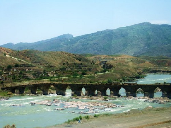
River Araz (Aras or Araks) have become border of northern and southern Azerbaijans. It also has become a symbol of divided Azerbaijan. Many Azerbaijani poets and artists take River Araz as subject of their works. A literature branch named “Hasret Edebiyatı” (literature of yearn) have been created which deals with Azerbaijan’s division. Araz is the main theme in Hasret Edebiyati.
Below of some photos of Araz River;


Sources:
– Azerbaijan Divided: History and Consequences by Karim Shukurov
http://araznews.org/english/news/190
– Photos are taken from gunaz.tv website